
Winchester and its Setting
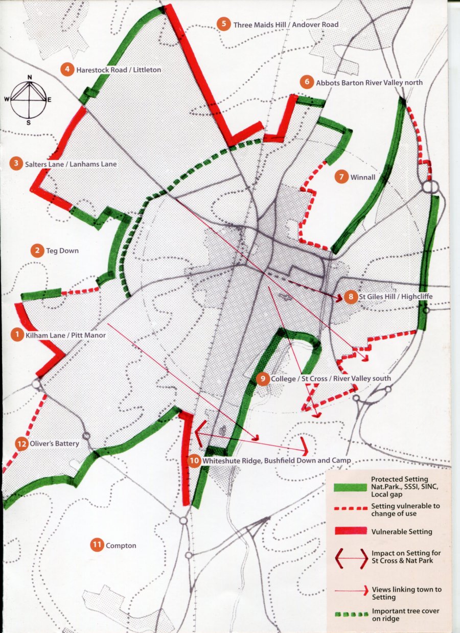
Map of Winchester showing its Setting vulnerability
Click to enlarge
Conclusion
The value and significance of the River Itchen, chalk downland and tree cover that combine to create the landscape setting for Winchester is subject to varying levels of protection and vulnerability. Numbers refer to the areas of the setting, shown on the map on this page.
Protected areas
On the assumption that national planning policies for the National Park, SSIs, and local planning policies for SINCs and Local Gaps remain robust, the areas of the setting that are provided with protection are:-
2. Teg Down, 4. Harestock, 6. Abbotts Barton, 7. Winnall (part),
8. Winnall/Highcliffe(east side), 9. River Itchen south, 11. Compton
Vulnerable areas
These areas, mainly used for recreation, could, if changes of use were permitted, accommodate limited and contained levels of development. If sensitively designed they could enhance the landscape setting.
2. Teg Down (south), 7. Winnall (south), 8. Highcliffe/Bar End, 12. Olivers Battery (NW)
Unprotected areas
These are areas that have no protection from proposals that would expand the city boundaries, which would have a serious impact on the setting and compromise the compactness of the City. They are:-
1. Kilham Lane/Pitt, 3.Salters Lane, 5. Barton Farm, 10. Bushfield
The Trusts conclude from this assessment of Winchester and its setting, that the landscape surrounding the whole of the City has an importance that planning authorities should recognize by designating it as a heritage asset in Development Plans.