
Title Picture - TrustNews Spring 1999
3 maps showing development of the Oram's Arbour/St James' Lane Area
1. Map by Godson, 1750, reproduced by kind permission of British Museum
2. OS Map of 1897
3. Map, as used for Neighbourhood studies
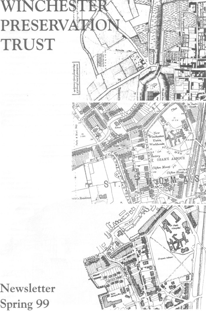
Title Picture - TrustNews Spring 1999
3 maps showing development of the Oram's Arbour/St James' Lane Area
1. Map by Godson, 1750, reproduced by kind permission of British Museum
2. OS Map of 1897
3. Map, as used for Neighbourhood studies