
Winchester and its Setting
Northern Setting
Three Maids Hill/Andover Road
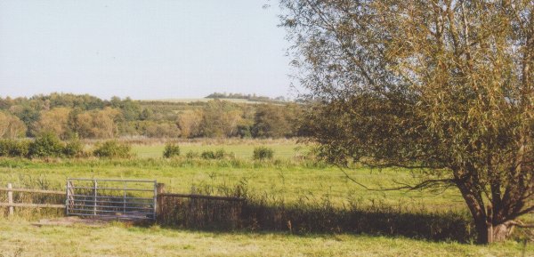
This area to the north of the City includes the 93 hectares of Barton Farm, which brings a green wedge of good quality farmland close to the city centre. As well as allowing a rural approach to Winchester along the Andover Road and the railway, this area of gently undulating arable land provides a visual link across the Itchen Valley to the South Downs National Park and gives panoramic views northwards to open countryside.
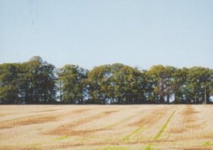
Use of trees on 65m ridge line, Barton Farm
A line of tall trees cuts across the site on the 65 metre ridge line north of which the land slopes gently to Well House Lane, with a steeper embankment at the NE corner. Along the southern edge a dense belt of tree cover softens the built-up residential area of Park Road and Old Gardens. These trees also contribute to the tree-lined horizon around the city. Barton Farm is designated as a reserve site for 2000 houses and supporting infrastructure, and has been the subject of successive planning applications and appeals. The latest was dismissed by the Secretary of State, partly on the grounds that the proposals did not meet planning policies seeking to protect and enhance the special and historic character of Winchester and its landscape setting. If development of this greenfield site eventually goes ahead, it would destroy the green wedge, and extend the urban edge of Winchester much further into the countryside and risk destroying one of the green wedges, which are such an important characteristic of the City, unless very carefully designed to perpetuate the green corridor.
View towards A34 from King's Way footpath at Abbotts Barton
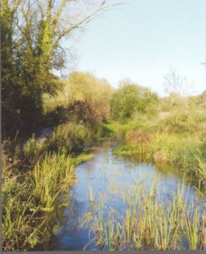
Winnall Moors
Abbotts Barton/River valley north
The dense housing of Hyde gives way northwards to sports fields in the river flood-plain and to the lower density housing of Abbotts Barton. North of this the proposed development of 90 houses in a field off Francis Gardens will reduce the rural gap, of less than a kilometer, between the built up area of Winchester and Headbourne Worthy/Kings Worthy.
Winnall
Winnall Moors is an area of floated water-meadows, now protected as a Nature Reserve, and provides an area of natural wetland close to the centre of the City. The eastern part is within the South Downs National Park. The northern extremity of the site extends as far as the A34 at Headbourne Worthy. At the southern end adjoining the built up area of the City are allotments, playing fields and the River Park Recreation Centre. To the east the Winnall Estate exists as a triangle of housing, superstores and industry, extending the built up area of the City northwards to the edge of Easton Down. The eastern boundary of the Winnall housing area is defined by the M3.